The Fjord laboratory
Fish strains collapse. Pacific oysters invade. What is going on in the Oslofjord?
– It's all about switching on the light under water.
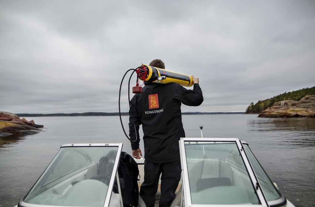
Last year, Kongsberg Maritime uncovered a German aircraft from World War II, the skeleton of a whale, garbage and shipwrecks. The findings were made as part of a technology show in the Oslo Fjord. Now Arne Hestnes from Kongsberg Maritime once again lowers the torpedo-shaped cylinder WBAT into the water. The cylinder is equipped with a scientific echo sounder to map out the marine environment in large parts of the Oslo fjord.
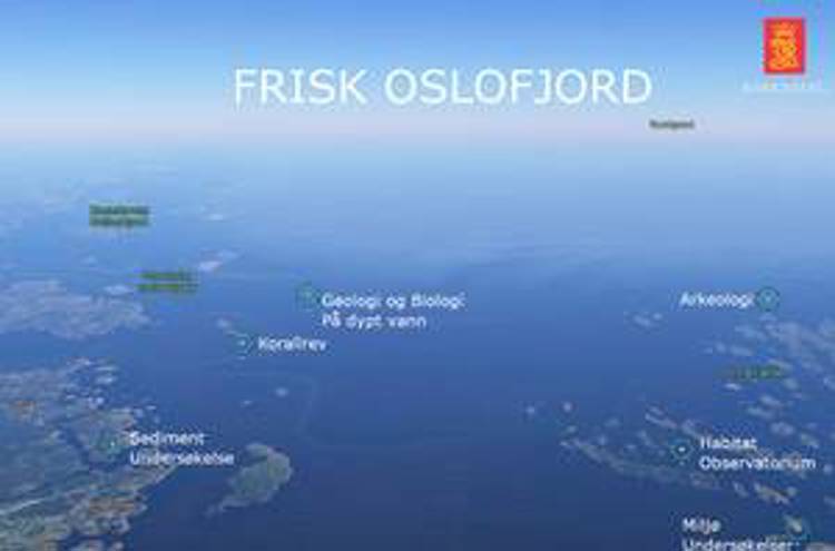
The collaboration project has been named "Frisk Oslofjord" (Fresh Oslofjord) and will for the first time give us a full health status for the fjord (see text box).
– We see that several species of fish are about to disappear. Tare forest disappears. The water has become warmer, and more southern species appear in the fjord, says Frithjof Moy at Havforskingsinstituttet (Institute of Marine Research). He is worried about the condition of the fjord. Lack of holistic knowledge means that no one fully knows what the status is. What we know is that the cod stock is about to disappear.
– We find almost no cod fry in the Oslofjord anymore. The local strain seems to be at an absolute minimum, Moy states.
– We see that small changes in the ecosystem can lead to major changes in the food chain. It is a complicated system and we are looking for new knowledge, explains Moy at the Institute of Marine Research.
Olav Falk-Pedersen and the county council of Vestfold see it as the start of a new industry - and a stronger interaction between industry, research and management.
– Fresh Oslofjord will be a pilot to further develop the technology. The research communities and we in the county municipalities will be demanding customers, which means that Norway can become a leader in marine management and that Kongsberg can develop and test new technology that can be exported, says Falk-Pedersen.
A micro sea
The Oslofjord is a micro-universe of what is happening in the sea. The conditions in the fjord are quickly affected by incidents in Sweden and Denmark. For example, a discharge at the northern tip of Denmark or events in the Baltic Sea will have an impact on the fjord within a few days.Olav Falk-Pedersen in Vestfold County Council believes this will change how we relate to the fjord and the sea.
– We have a great demand to put in place an ecological basic map to manage the fjord in a good way, says Falk-Pedersen.

the keys to the seabed
– If you lose the car keys, we can find them.
Now they have cracked the code to have the rest of the Norwegian coast surveyed. It stretches a whole two and a half times around the equator. With modern technology, such mapping can be done with greater accuracy and at a fraction of the cost compared to the previously.
– We can make pictures of the seabed with details down to 2 - 4 centimetres’ resolution at 500 metres distance, says Jalving.
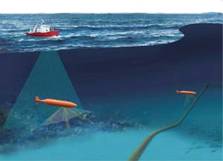
The experience from last year's environmental mission shows the potential. In just two days, an aircraft, a ship and large amounts of marine litter were mapped, as well as various marine landscapes.Or for that matter car keys on the seabed. "The technology has the potential to revolutionize the way we map the coast," concludes Vestfold county in its report from the cruise.Now the pilot will create the first ecological basis map - which gives a complete overview - over the seabed.
By 2021, Jalving expects to have a new way of monitoring, mapping and managing the coast. A little further ahead, Jalving sees an entirely new offshore infrastructure - providing researchers, students, the administration and business - a real digital twin of the sea.
– By 2030 I think we will have hundreds of such measuring stations that give us real-time overview of the development in larger parts of the sea, says Jalving.The vision is shared by Moy at the Institute of Marine Research.
– We imagine that in the future we can navigate around in a 3D version of a fully illuminated marine landscape, as in a computer game. By putting out a virtual pier, a case officer can see how it can affect ocean currents and marine life, Moy explains.- The administration can then demand that if it is to be built here, then it must be done in this or this way. To achieve this, we need a marine ecological basic map, Moy points out.
The quest for the secret of the world's oceans
Today, only 15 percent of the world's oceans have been surveyed. Now Kongsberg Gruppen is participating as a contributor to the international marine competition Shell Ocean Discovery Xprize, where the winner is the one who is best at charting a large sea area. The purpose is to stimulate faster mapping of the oceans, as a necessary basis for sustainable development of the Earth.
The final task is to map an area three times the size of Paris - with depths of twice the Grand Canyon within 24 hours of November. Kongsberg delivers solutions and technology to the international team Gebco-NF-Alumni Team.
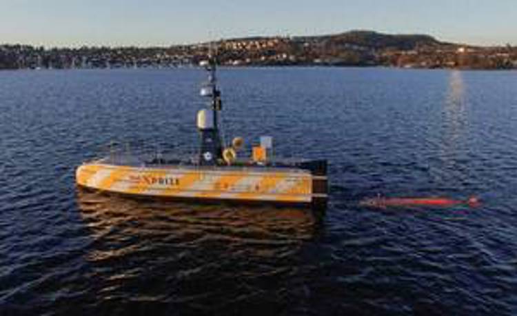
– Gebco-NF Alumni Team takes existing commercial products and integrates them into an unmanned system, explains Kongsberg Gruppen's Bjørn Jalving.
Gebco-NF Alumni Team consists of an unmanned surface vessel (USV Unmanned Surface Vehicle), which brings the Kongsberg Group's autonomous underwater vehicle, Hugin, into the operating area. The USV is equipped with sensor systems and autonomy from Kongsberg Maritime. Hugin operates from the USV and maps down to 6000 m depths.
– Robotics and modern cloud-based data sharing solutions make the vision of turning on the light under water realistic, says Jalving.