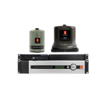
Seapath
Seapath is a navigation system that combines satellite and inertial navigation technology to achieve exceptional accuracy for surveyors mapping depths down to 10.000 meters.
Introduced in 1994, the Seapath has been continually refined to ensure state-of-the-art robust and precise systems. These systems are designed for challenging applications and environments, enabling optimal seabed mapping by measuring heading, position, roll, pitch, heave and timing, with unparalleled precision.
Products
2 products
Get in touch!
In addition to our many offices around the world, our global dealership network enables distribution to more than 100 countries to meet customer needs at any location. Find your local dealership or Kongsberg Discovery office here.