Ports

Ports are critical to the economic activity of all nations. Ports deal with a variety of competing interests: larger vessels push the need for dredging of deeper channels and strengthening bollards for higher tensile loads. Yet all port projects must proceed in compliance with environmental regulations and minimal disruption to ongoing revenue-generating operations. As man-made structures like wharves, jetties and navigation aids age, underwater inspection becomes vital. Water currents, corrosion, and damage from storms and vessel impacts may also reduce structure integrity. Diving inspections can be costly and dangerous due to a lack of visibility. Inconsistency in data reporting by divers is not un-common. Multibeam echo sounders and high-resolution scanning sonars assist civil engineers and divers by producing high definition images for these conditions for periodic inspections. Now, permanently installed sensors provide continuous, real-time data streams to key stakeholders on demand, when required for their specific operations.

Sub-bottom profiling

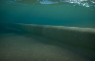
Not all areas being dredged are soft material. There can be a number of solid obstacles in the area to be dredged that can damage dredging equipment if not identified prior to operations. These can include unexploded ordnance, rocks, buried pipelines, and uncharted tramp material like lost anchors or dumped materials. Sub-bottom profilers can identify solids so they can be removed prior to dredging operations.

Post-storm navigation recovery

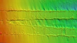
Many ports are located in river deltas with high siltation loads. Ports are also subject to hurricanes and typhoons with their associated storm surges. Ports need to regularly survey their channels and berths to ensure their clients can operate safely. The recent Athos I legal case amplifies the responsibility of port authorities and terminal operators to provide safe approaches to their berths. Kongsberg offers single-beam and multi-bream echosounders for high accuracy survey in these critical areas.

Channel and berth survey

Many ports are located in river deltas with high siltation loads. Ports are also subject to hurricanes and typhoons with their associated storm surges. Ports need to regularly survey their channels and berths to ensure their clients can operate safely. The recent Athos I legal case amplifies the responsibility of port authorities and terminal operators to provide safe approaches to their berths. Kongsberg offers single-beam and multi-bream echosounders for high accuracy survey in these critical areas.

Security and defense

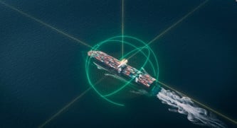
Kongsberg sonar are used by navies for counter-mines measures. In ports, the threat is from improvised explosive devices. Authorities responsible for port security need to locate and identify potential threats before they can be activated. For these applications, high resolution, long range and clarity of image are key to identify targets and assess their potential lethality.

Infrastructure inspection

There are approximately 91,000 dams in the US. In addition, “As of 2019, there are approximately 15,600 dams in the United States that are classified as high-hazard structures” (Dam Infrastructure | ASCE's 2021 Infrastructure Report Card). 

Dams perform vital functions for water flow control, hydroelectric power generation, and water storage for agricultural, industrial, and domestic consumption. They are also used to retain mining tailings, food processing wastewater, and sewage during treatment. Structural integrity of dams is critical to ensure they do not fail. Operators must ensure inlets are clear of trash that could harm the dam flow control mechanisms or power generation equipment. Kongsberg sensors can be deployed on ROVs, surface vessels, or remotely using mechanical deployment systems for persistent or periodic acoustic inspection and to monitor sediment and debris levels. This data provides dam operators and civil engineers with critical information they can use for condition assessment and maintenance planning.

Damaged-dam-apron_1166x477.jpg

Berthwatch

Berthwatch is a system for continually monitoring the depth in a berth pocket and reporting it to pilots and vessel masters. This allows vessels to maximize loads on departure, increases confidence on arrival, and provides alarm conditions if foreign objects enter the berth pocket after storm events before the port is able to mobilize a full survey.

Related products

      Contact

      • Helge Uhlen

        Vice President Underwater Mapping Sales
      • Aziah North

        MESI Product Sales Manager
      go to next slide
      go to next slide
      go to next slide
      go to next slide
      go to next slide
      go to next slide